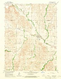
1964 Map of Barnard
USGS Topo · Published 1966About this map
Barnard serves as the central hub of this mid-century Kansas landscape, situated where the Atchison Topeka and Santa Fe railroad crosses the meandering waters of Salt Creek. The map documents a rural economy defined by agriculture and extraction, with numerous quarries and gravel pits scattered across the surrounding townships of Eureka, Scott, and Logan. These industrial markings contrast with the preservation of local lineage found at Union Valley Cem, Milo Cem, and Elkhorn Cem.
Find a feature on this map
27 named features on this map. Tap any name to fly to it.
Don’t see what you’re looking for? This feature index may not catch every label — zoom into the map to look around manually.
Map Details
Editions of this 1964 Barnard Map
2 editions found
Other maps of this area

1892 · Minneapolis
USGS Topo · 1:125,000

1894 · Beloit
USGS Topo · 1:125,000

1952 · Glasco SW
USGS Topo · 1:24,000

1955 · Manhattan
USGS Topo · 1:250,000

1955 · Beloit
USGS Topo · 1:250,000

1956 · Manhattan
USGS Topo · 1:250,000

1957 · Manhattan
USGS Topo · 1:250,000

1959 · Beloit
USGS Topo · 1:250,000

1962 · Lincoln
USGS Topo · 1:24,000
1963 · Shady Bend
USGS Topo · 1:24,000