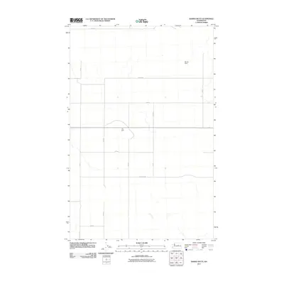
2011 Map of Barnes Butte
USGS Topo · Published 2011About this map
Barnes Butte and the Pot Hills define the high desert topography of this Douglas County landscape during the early 21st century. The map depicts a strictly organized rural grid of section lines and gravel roads, reflecting the large-scale agricultural and ranching patterns of the region. Notable routes like Hayden Rd NE and Road 18 NE intersect the dry terrain, providing access to the vast open spaces between these isolated volcanic or erosional rises. This USGS survey highlights the characteristic eastern Washington layout where infrastructure is dictated by the township and range system, with ephemeral drainage patterns and small depressions scattered across the plateau between Woods Rd NE and the eastern boundary.
Find a feature on this map
14 named features on this map. Tap any name to fly to it.
Don’t see what you’re looking for? This feature index may not catch every label — zoom into the map to look around manually.
Map Details
Editions of this 2011 Barnes Butte Map
This is the sole edition of this map. No revisions or reprints were ever made.
Other maps of this area

1930 · Grand Coulee Sheet 3
USGS Topo · 1:31,680

1953 · Ritzville
USGS Topo · 1:250,000

1959 · Ritzville
USGS Topo · 1:250,000

1965 · Ritzville
USGS Topo · 1:250,000

1965 · St. Andrews
USGS Topo · 1:24,000

1965 · Jameson Lake East
USGS Topo · 1:24,000

1965 · Mold
USGS Topo · 1:24,000

1968 · Coleman Hill
USGS Topo · 1:24,000
1968 · Barnes Butte
USGS Topo · 1:24,000

1968 · Foster Coulee
USGS Topo · 1:24,000