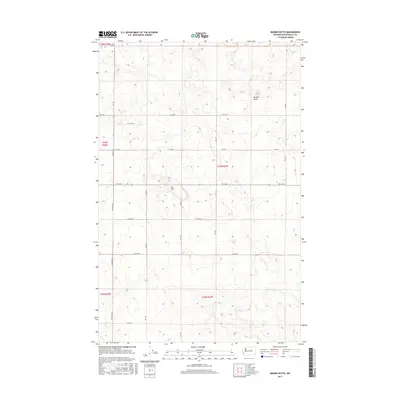
2017 Map of Barnes Butte
USGS Topo · Published 2017About this map
Barnes Butte stands as a prominent landmark in this section of Douglas County, where the high plateau landscape is defined by a rigorous grid of section lines and rural corridors. The terrain is characterized by the rolling elevations of the Pot Hills and the geometric precision of the Public Land Survey System, which dictates the placement of long, straight thoroughfares like Heritage Rd and Rd 14 Ne. This 2017 U.S. Geological Survey representation illustrates a region shaped by agricultural planning and low-density land use, typical of the arid central Washington interior. While the map is sparse in terms of traditional town centers, the named road network—including Rd 10 Ne and Rd L Ne—reveals the infrastructure supporting the vast ranching or farming tracts that dominate the county's northern reaches.
Find a feature on this map
22 named features on this map. Tap any name to fly to it.
Don’t see what you’re looking for? This feature index may not catch every label — zoom into the map to look around manually.
Map Details
Editions of this 2017 Barnes Butte Map
This is the sole edition of this map. No revisions or reprints were ever made.
Other maps of this area

1930 · Grand Coulee Sheet 3
USGS Topo · 1:31,680

1953 · Ritzville
USGS Topo · 1:250,000

1959 · Ritzville
USGS Topo · 1:250,000

1965 · Ritzville
USGS Topo · 1:250,000

1965 · St. Andrews
USGS Topo · 1:24,000

1965 · Jameson Lake East
USGS Topo · 1:24,000

1965 · Mold
USGS Topo · 1:24,000

1968 · Coleman Hill
USGS Topo · 1:24,000
1968 · Barnes Butte
USGS Topo · 1:24,000

1968 · Foster Coulee
USGS Topo · 1:24,000