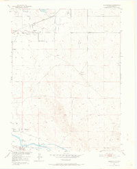
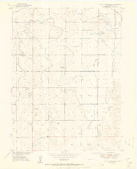
1950 Map of Barnesville
USGS Topo · Published 1969About this map
Cem (First Permanent Settlers in Weld Co 1840) marks a site of significant genealogical and local importance, located near the confluence of Crow Creek and the South Platte River. This landscape is defined by the complex agricultural irrigation networks that supported the High Plains during the mid-century, including the Hoover Ditch, Union Pacific Ditch, and Riverside Intake Canal. The small settlement of Barnesville appears as a focal point of rural life, featuring the Barnesville School and a Union Pacific rail stop at Barnesville Station. Further south, the community of Kuner sits near the riverbanks, while the presence of Wells Cow Camp and scattered windmills highlights the region's ranching heritage. The map documents an era when local transport and water rights were the primary drivers of settlement in the eastern Colorado plains.
Find a feature on this map
19 named features on this map. Tap any name to fly to it.
Don’t see what you’re looking for? This feature index may not catch every label — zoom into the map to look around manually.
Map Details
Editions of this 1950 Barnesville Map
5 editions found
Other maps of this area

1902 · Greeley
USGS Topo · 1:125,000

1908 · Eaton
USGS Topo · 1:125,000

1910 · Eaton
USGS Topo · 1:125,000

1950 · Kersey
USGS Topo · 1:24,000

1950 · Barnesville
USGS Topo · 1:24,000

1950 · Valley View School
USGS Topo · 1:24,000

1950 · Hardin
USGS Topo · 1:24,000

1951 · Hardin
USGS Topo · 1:24,000
1951 · Valley View School
USGS Topo · 1:24,000

1951 · Point Of Rocks
USGS Topo · 1:24,000