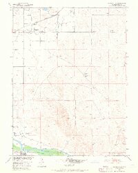
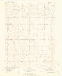
1950 Map of Barnesville
USGS Topo · Published 1969About this map
The South Platte River and its intricate irrigation network dominate this agricultural landscape in mid-century Colorado. A significant historical marker is noted at the Cem (First Permanent Settlers in Weld Co 1840), providing a rare genealogical link to the region's earliest non-indigenous inhabitants. The small community of Barnesville serves as a local hub, featuring the Barnesville School and a Union Pacific rail stop at Barnesville Station.
Find a feature on this map
18 named features on this map. Tap any name to fly to it.
Don’t see what you’re looking for? This feature index may not catch every label — zoom into the map to look around manually.
Map Details
Editions of this 1950 Barnesville Map
5 editions found
Other maps of this area

1902 · Greeley
USGS Topo · 1:125,000

1908 · Eaton
USGS Topo · 1:125,000

1910 · Eaton
USGS Topo · 1:125,000

1950 · Kersey
USGS Topo · 1:24,000

1950 · Barnesville
USGS Topo · 1:24,000

1950 · Valley View School
USGS Topo · 1:24,000

1950 · Hardin
USGS Topo · 1:24,000

1951 · Hardin
USGS Topo · 1:24,000
1951 · Valley View School
USGS Topo · 1:24,000

1951 · Point Of Rocks
USGS Topo · 1:24,000