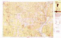
1983 Map of Barnet
USGS Topo · Published 1983About this map
Harvey Lake and the Connecticut River define this portion of the Vermont and New Hampshire border, where the river valley supports several historic settlements including McIndoe Falls and Monroe. The landscape is characterized by a series of high ridges like Lookout Mtn and Macks Mountain, separated by numerous small ponds and bogs such as Peacham Bog. In the early 1980s, the Canadian Pacific railroad line still traced the western bank of the Connecticut River, serving as a vital transport corridor for the communities of Barnet and East Barnet. Land use in the western portion of the sheet is heavily oriented toward conservation and timber, dominated by the Groton State Forest and the Roy Mountain Wildlife Management Area. Numerous small rural hamlets like Ewells Mills, East Peacham, and Mosquitoville are connected by a network of local roads that snake through the hills of Peacham and Barnet townships.
Find a feature on this map
75 named features on this map. Tap any name to fly to it.
Don’t see what you’re looking for? This feature index may not catch every label — zoom into the map to look around manually.
Map Details
Editions of this 1983 Barnet Map
This is the sole edition of this map. No revisions or reprints were ever made.
Other maps of this area

1929 · Moosilauke
USGS Topo · 1:62,500

1931 · Littleton
USGS Topo · 1:62,500

1931 · Woodsville
USGS Topo · 1:48,000

1932 · Littleton
USGS Topo · 1:48,000

1932 · Moosilauke
USGS Topo · 1:62,500

1935 · Woodsville
USGS Topo · 1:62,500

1935 · Littleton
USGS Topo · 1:62,500

1938 · St. Johnsbury
USGS Topo · 1:48,000

1939 · Plainfield
USGS Topo · 1:48,000

1940 · Plainfield
USGS Topo · 1:62,500