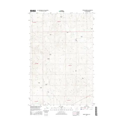
2017 Map of Barney Pinnacle
USGS Topo · Published 2017About this map
Barney Pinnacle rises above a landscape defined by an intricate network of drainages and traditional ranching access in Garfield County. This 2017 survey details a terrain carved by numerous coulees, such as Nordahl Coulee, Eaton Coulee, and Wagga Coulee, which channel seasonal water toward Calf Cr and the N Fork Sage Hen Cr. The topography reveals a sparsely populated region where movement is dictated by the land's natural folds, connected by routes like Stage Rd and W Calf Crk Rd. The map illustrates the persistent Public Land Survey System grid across high plains, punctuated by landmarks like Twin Butte and Long Coulee. For those studying land use or regional history, the persistence of family-named features like Barkdoll Coulee and Williams Coulee provides a connection to the ranching heritage that continues to shape this part of Montana.
Find a feature on this map
25 named features on this map. Tap any name to fly to it.
Don’t see what you’re looking for? This feature index may not catch every label — zoom into the map to look around manually.
Map Details
Editions of this 2017 Barney Pinnacle Map
This is the sole edition of this map. No revisions or reprints were ever made.
Other maps of this area

1954 · Jordan
USGS Topo · 1:250,000

1954 · Forsyth
USGS Topo · 1:250,000

1956 · Jordan
USGS Topo · 1:250,000

1957 · Forsyth
USGS Topo · 1:250,000

1958 · Jordan
USGS Topo · 1:250,000

1958 · Forsyth
USGS Topo · 1:250,000

1962 · Mosby
USGS Topo · 1:24,000
1963 · Hill Ranch
USGS Topo · 1:24,000
1963 · Dutton Ranch
USGS Topo · 1:24,000

1964 · Jordan
USGS Topo · 1:250,000