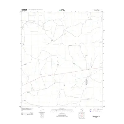
2012 Map of Barnhart NE
USGS Topo · Published 2012About this map
Cedar Hill rises over an arid landscape dominated by ranching infrastructure and water-management features in Irion County. The map reveals the critical importance of localized water sources in this part of West Texas, documented through a dense network of named windmills such as Baze Windmill, Brooks Windmill, and Fivemile Windmill. These landmarks serve as vital navigational points across a terrain otherwise defined by drainage patterns like Spring Cr and the convergent paths of West Dutch Woman Draw and East Dutch Woman Draw. Transportation is primarily limited to rural routes, including Dutchwoman Rd and Co Rd 131, which connect the scattered agricultural operations. The naming of features like Shearing Pen Windmill and Caliche Windmill provides a window into the specific materials and ranching activities that have sustained this region into the early 21st century.
Find a feature on this map
22 named features on this map. Tap any name to fly to it.
Don’t see what you’re looking for? This feature index may not catch every label — zoom into the map to look around manually.
Map Details
Editions of this 2012 Barnhart NE Map
This is the sole edition of this map. No revisions or reprints were ever made.
Other maps of this area

1895 · Sherwood
USGS Topo · 1:125,000

1920 · Barnhart
USGS Topo · 1:62,500

1921 · Ketchum Mountain
USGS Topo · 1:62,500

1922 · Barnhart
USGS Topo · 1:62,500

1923 · Ketchum Mountain
USGS Topo · 1:62,500

1954 · San Angelo
USGS Topo · 1:250,000

1958 · San Angelo
USGS Topo · 1:250,000

1965 · San Angelo
USGS Topo · 1:250,000
1971 · Barnhart SW
USGS Topo · 1:24,000

1971 · Noelke
USGS Topo · 1:24,000