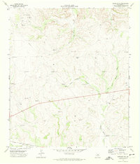
1971 Map of Barnhart NE
USGS Topo · Published 1974About this map
Ketchum Oil Field anchors the northern reaches of this Irion County landscape, illustrating the critical role of petroleum extraction in the West Texas economy during the early 1970s. The terrain is defined by a dense network of drainage channels including Big Hollow Draw and the distinct forks of West Dutch Woman Draw and East Dutch Woman Draw. Life in this arid environment is visibly supported by numerous dispersed water sources, evidenced by named landmarks such as Brooks Windmill, Shearing Pen Windmill, and Dutch Woman Windmill. Along the southern margin, the Atchison Topeka and Santa Fe railroad tracks run parallel to Spring Creek, marking the primary transportation artery for the region. The presence of a Radio Tower and various pipelines indicates a landscape transitioning between traditional ranching and modern industrial infrastructure.
Find a feature on this map
29 named features on this map. Tap any name to fly to it.
Don’t see what you’re looking for? This feature index may not catch every label — zoom into the map to look around manually.
Map Details
Editions of this 1971 Barnhart NE Map
This is the sole edition of this map. No revisions or reprints were ever made.
Other maps of this area

1895 · Sherwood
USGS Topo · 1:125,000

1920 · Barnhart
USGS Topo · 1:62,500

1921 · Ketchum Mountain
USGS Topo · 1:62,500

1922 · Barnhart
USGS Topo · 1:62,500

1923 · Ketchum Mountain
USGS Topo · 1:62,500

1954 · San Angelo
USGS Topo · 1:250,000

1958 · San Angelo
USGS Topo · 1:250,000

1965 · San Angelo
USGS Topo · 1:250,000
1971 · Barnhart SW
USGS Topo · 1:24,000

1971 · Noelke
USGS Topo · 1:24,000