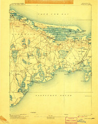
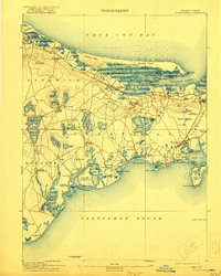
1893 Map of Barnstable
USGS Topo · Published 1907About this map
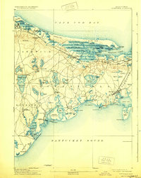
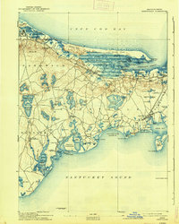
The Great Marshes dominate the northern shoreline of this coastal survey, where the Old Colony Railroad Cape Cod Branch tracks the shoreline toward Yarmouth Port. This late-19th-century landscape reveals a well-developed maritime and social network across the Mid-Cape, from the educational grounds of Spring Hill Academy to the religious history preserved at the Indian Meeting House in Mashpee. The map captures the distinct character of the villages before mid-century modernization, showing the specific layout of landings and ports like Cotuit Port and Osterville Landing. Navigational aids like Sandy Neck Light and Hyannis Light mark the treacherous approaches to Barnstable Harbor and Hyannis Harbor. Local transit is centered on railroad depots such as East Sandwich Station and West Barnstable Station, connecting inland ponds and agricultural hamlets like Farmersville and Marstons Mills to the wider commerce of Cape Cod Bay and Nantucket Sound.
Find a feature on this map
128 named features on this map. Tap any name to fly to it.
Don’t see what you’re looking for? This feature index may not catch every label — zoom into the map to look around manually.
Map Details
Editions of this 1893 Barnstable Map
8 editions found
Other maps of this area

1886 · Falmouth
USGS Topo · 1:62,500

1886 · Plymouth
USGS Topo · 1:62,500

1887 · Yarmouth
USGS Topo · 1:62,500

1888 · Barnstable
USGS Topo · 1:62,500

1888 · Falmouth
USGS Topo · 1:62,500

1889 · Plymouth
USGS Topo · 1:62,500

1889 · Yarmouth
USGS Topo · 1:62,500

1893 · Yarmouth
USGS Topo · 1:62,500

1893 · Barnstable
USGS Topo · 1:62,500

1893 · Falmouth
USGS Topo · 1:62,500