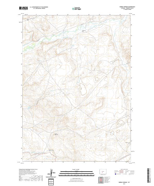
2021 Map of Barras Springs
USGS Topo · Published 2021About this map
The Oregon Trl and Emigrant Trl define the historical transit corridor through this section of Fremont County, following the gentle northern grade of the Sweetwater River. The landscape is shaped by significant topographic breaks, most notably the high escarpment of Beaver Rim in the northwest and the prominent elevation of North Bear Mtn further south. Water sources were critical for travelers in this arid region, evidenced by named sites such as Barras Springs, Mud Spring, and Lower Ladysmith Spring. Modern infrastructure includes the Hudson-Atlantic City Rd, which intersects these older paths near Stough Lake. This area also serves as a point of intersection for recreational and agricultural history, from the Continental Divide National Scenic Trl to local irrigation efforts like the Arnold-Ditch Number 1 and Brown Ditch.
Find a feature on this map
23 named features on this map. Tap any name to fly to it.
Don’t see what you’re looking for? This feature index may not catch every label — zoom into the map to look around manually.
Map Details
Editions of this 2021 Barras Springs Map
This is the sole edition of this map. No revisions or reprints were ever made.
Other maps of this area

1953 · Lewiston Lakes
USGS Topo · 1:24,000

1953 · Barras Springs
USGS Topo · 1:24,000

1953 · Sweetwater Station
USGS Topo · 1:24,000

1953 · Happy Spring
USGS Topo · 1:24,000

1953 · Schlichting Mountain
USGS Topo · 1:24,000

1953 · Red Canyon
USGS Topo · 1:24,000

1955 · Lander
USGS Topo · 1:250,000
1957 · Red Canyon
USGS Topo · 1:24,000

1958 · Lander
USGS Topo · 1:250,000
1958 · Schoettlin Mountain
USGS Topo · 1:24,000