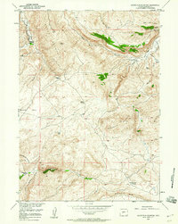
1958 Map of Schoettlin Mountain
USGS Topo · Published 1960About this map
Schoettlin Mountain and the high plateaus of Beaver Rim define this portion of Fremont County, where the high desert terrain of the McGraw Flats meets the deeply incised drainage of Beaver Creek. During the late 1950s, this landscape was characterized by isolated cattle operations and early industrial exploration, evidenced by Oil Wells located near Sheep Mountain. The map provides a detailed record of water sources essential for survival in this arid environment, including Hot Spring, Sulphur Spring, and Miller Spring. Local genealogy is anchored by established homesteads like the Bergstedt Ranch, Mathisen Ranch, and Woolery Ranch, which represent the ranching heritage of the Wind River Basin. Prominent geological landmarks such as the Red Bluff and Dilabaugh Buttes help trace the elevation changes between the draws and mountain peaks.
Find a feature on this map
28 named features on this map. Tap any name to fly to it.
Don’t see what you’re looking for? This feature index may not catch every label — zoom into the map to look around manually.
Map Details
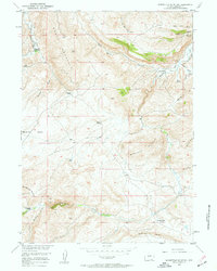
Editions of this 1958 Schoettlin Mountain Map
2 editions found
Other maps of this area

1953 · Lewiston Lakes
USGS Topo · 1:24,000

1953 · Barras Springs
USGS Topo · 1:24,000

1953 · Gravel Spring
USGS Topo · 1:24,000

1953 · Radium Springs
USGS Topo · 1:24,000

1953 · Schlichting Mountain
USGS Topo · 1:24,000

1953 · Del Monte Ridge
USGS Topo · 1:24,000

1953 · Yellowstone Ranch
USGS Topo · 1:24,000

1953 · Red Canyon
USGS Topo · 1:24,000

1953 · Weiser Pass
USGS Topo · 1:24,000

1955 · Lander
USGS Topo · 1:250,000