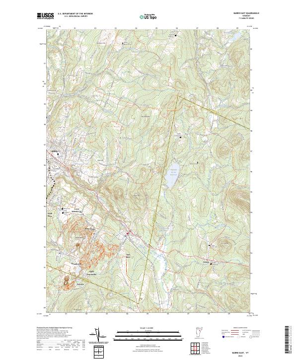
2024 Map of Barre East
USGS Topo · Published 2024About this map
Millstone Hill and the surrounding granite-producing communities define the landscape southeast of Barre. This contemporary survey reveals the cluster of industrial villages including Websterville, Graniteville, and Upper Graniteville, where the geography of the hills is inextricably linked to the region's quarrying heritage. The terrain is deeply carved by the Jail Branch and its tributaries, while the Thurman W. Dix Reservoir and Lower Orange Reservoir provide critical water infrastructure for the area.
Find a feature on this map
168 named features on this map. Tap any name to fly to it.
Don’t see what you’re looking for? This feature index may not catch every label — zoom into the map to look around manually.
Map Details
Editions of this 2024 Barre East Map
This is the sole edition of this map. No revisions or reprints were ever made.
Other maps of this area

1919 · Montpelier
USGS Topo · 1:62,500

1921 · Montpelier
USGS Topo · 1:62,500

1922 · Barre
USGS Topo · 1:48,000

1924 · Barre
USGS Topo · 1:62,500

1939 · Plainfield
USGS Topo · 1:48,000

1940 · Plainfield
USGS Topo · 1:62,500

1943 · Plainfield
USGS Topo · 1:62,500

1944 · Montpelier
USGS Topo · 1:62,500

1947 · Corinth
USGS Topo · 1:62,500

1948 · East Barre
USGS Topo · 1:62,500