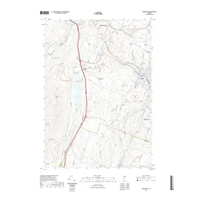
2021 Map of Barre West
USGS Topo · Published 2021About this map
The Winooski River and Dog River corridors anchor this 2021 landscape between the major Vermont centers of Montpelier and Barre. Historically centered on the high ground of Berlin Corners, the area is defined by the significant basin of Berlin Pond and the surrounding peaks of Irish Hill and Paine Mtn. The map reveals a high concentration of ancestral burial grounds scattered across the hillsides, such as Johnson-Sawyer Cem, Dewey-Wright Cem, and Loomis Cem, which provide critical markers for genealogists researching early settlement patterns. Industrial and modern transportation infrastructure is represented by the Edward F Knapp State Airport and the commercial development along the Barre-Montpelier Rd, while the southern reaches near the Washington Co and Orange Co line transition into the more rural landscape of South Barre.
Find a feature on this map
131 named features on this map. Tap any name to fly to it.
Don’t see what you’re looking for? This feature index may not catch every label — zoom into the map to look around manually.
Map Details
Editions of this 2021 Barre West Map
This is the sole edition of this map. No revisions or reprints were ever made.
Other maps of this area

1919 · Montpelier
USGS Topo · 1:62,500

1921 · Montpelier
USGS Topo · 1:62,500

1922 · Barre
USGS Topo · 1:48,000

1924 · Barre
USGS Topo · 1:62,500

1939 · Plainfield
USGS Topo · 1:48,000

1940 · Plainfield
USGS Topo · 1:62,500

1943 · Plainfield
USGS Topo · 1:62,500

1944 · Montpelier
USGS Topo · 1:62,500

1947 · Corinth
USGS Topo · 1:62,500

1948 · East Barre
USGS Topo · 1:62,500