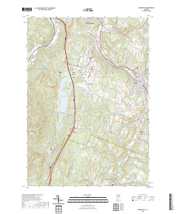
2024 Map of Barre West
USGS Topo · Published 2024About this map
Montpelier and Barre anchor this portion of the Vermont highlands, where the Winooski River and Dog River converge amidst a landscape of prominent peaks like Irish Hill and Paine Mtn. The infrastructure of the early 21st century is defined by the corridor of I-89 and VT Rte 62, which connects the regional hub of Berlin Corners to the Edward F Knapp State Airport. Local genealogy is well-documented through numerous burial sites such as Dewey-Wright Cem, Howard Cem, and the expansive Hope Cem near the city center. The map reveals the intricate water management system of the area, including Berlin Pond and the Bolster Reservoir, which sit between the developed urban centers and the higher elevations of West Hill. These features illustrate the balance between the region's industrial heritage, represented by the Central Vermont RR, and its modern administrative role as seen at the Washington County Courthouse Criminal Division.
Find a feature on this map
118 named features on this map. Tap any name to fly to it.
Don’t see what you’re looking for? This feature index may not catch every label — zoom into the map to look around manually.
Map Details
Editions of this 2024 Barre West Map
This is the sole edition of this map. No revisions or reprints were ever made.
Other maps of this area

1919 · Montpelier
USGS Topo · 1:62,500

1921 · Montpelier
USGS Topo · 1:62,500

1922 · Barre
USGS Topo · 1:48,000

1924 · Barre
USGS Topo · 1:62,500

1939 · Plainfield
USGS Topo · 1:48,000

1940 · Plainfield
USGS Topo · 1:62,500

1943 · Plainfield
USGS Topo · 1:62,500

1944 · Montpelier
USGS Topo · 1:62,500

1947 · Corinth
USGS Topo · 1:62,500

1948 · East Barre
USGS Topo · 1:62,500