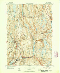
1954 Map of Barre
USGS Topo · Published 1955About this map
The Ware River and its various tributaries, including the Burnshirt River, anchor this mid-century portrait of central Massachusetts. Industry and transport are closely tied to the water, visible at Williamsville and White Valley, where the Quabbin Aqueduct cuts underground toward the east. This 1950s landscape shows the transition from earlier mill-based economies to a modern rural-residential layout, with the New York Central and Boston and Albany railroads still defining the corridors through Barre Plains and South Barre.
Find a feature on this map
66 named features on this map. Tap any name to fly to it.
Don’t see what you’re looking for? This feature index may not catch every label — zoom into the map to look around manually.
Map Details
Editions of this 1954 Barre Map
4 editions found
Other maps of this area

1885 · Worcester
USGS Topo · 1:62,500

1886 · Worcester
USGS Topo · 1:62,500

1887 · Winchendon
USGS Topo · 1:62,500

1887 · Barre
USGS Topo · 1:62,500

1887 · Fitchburg
USGS Topo · 1:62,500

1889 · Fitchburg
USGS Topo · 1:62,500

1889 · Barre
USGS Topo · 1:62,500

1890 · Winchendon
USGS Topo · 1:62,500

1892 · Worcester
USGS Topo · 1:62,500

1893 · Fitchburg
USGS Topo · 1:62,500