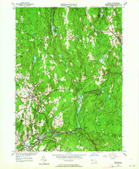
1954 Map of Barre
USGS Topo · Published 1964About this map
The Ware River valley serves as the industrial and transportation spine of this mid-century Massachusetts landscape. While the village of Barre sits on higher ground, the industrial activity centers on South Barre and Barre Plains, where the Central Massachusetts RR follows the river's path. Traces of the region's 19th-century manufacturing legacy are visible at Powder Mill Pond, while the modern hydrological infrastructure of the Quabbin Aqueduct cuts across the southeastern portion of the map near Coldbrook Springs.
Find a feature on this map
85 named features on this map. Tap any name to fly to it.
Don’t see what you’re looking for? This feature index may not catch every label — zoom into the map to look around manually.
Map Details
Editions of this 1954 Barre Map
4 editions found
Other maps of this area

1885 · Worcester
USGS Topo · 1:62,500

1886 · Worcester
USGS Topo · 1:62,500

1887 · Winchendon
USGS Topo · 1:62,500

1887 · Barre
USGS Topo · 1:62,500

1887 · Fitchburg
USGS Topo · 1:62,500

1889 · Fitchburg
USGS Topo · 1:62,500

1889 · Barre
USGS Topo · 1:62,500

1890 · Winchendon
USGS Topo · 1:62,500

1892 · Worcester
USGS Topo · 1:62,500

1893 · Fitchburg
USGS Topo · 1:62,500