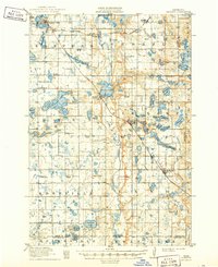
1911 Map of Barrett
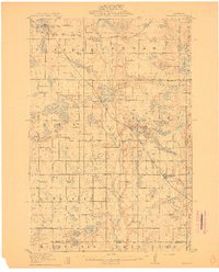
USGS Topo · Published 1949About this map
The Pomme de Terre River carves a central path through this glacial landscape, connecting a chain of water bodies from Pomme de Terre Lake down to Barrett Lake. At the turn of the century, this region of Grant County was defined by its emerging rail hubs and a dense network of rural schoolhouses, such as School No 53 and School No 32, which served the surrounding townships of Elk Lake and Lien. Two major rail lines, the Great Northern and the Minneapolis St. Paul and Sault Ste. Marie R. R., intersect the territory, driving the growth of settlements like Elbow Lake and Hoffman. Smaller, quieter communities like Thorsborg and local landmarks such as Union Church provide a detailed look at the social fabric of the era, while the eastern border reveals the early boundary lines between Grant, Douglas, and Stevens counties.
Find a feature on this map
69 named features on this map. Tap any name to fly to it.
Don’t see what you’re looking for? This feature index may not catch every label — zoom into the map to look around manually.
Map Details
Editions of this 1911 Barrett Map
2 editions found
Historical Maps of Elbow Lake Through Time
1 maps found