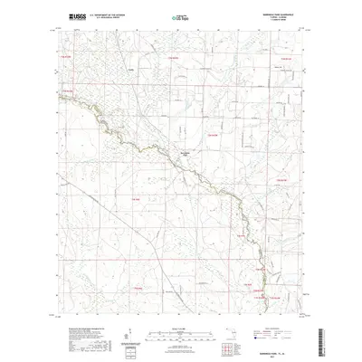
2021 Map of Barrineau Park
USGS Topo · Published 2021About this map
The Perdido River forms the winding interstate boundary between Florida and Alabama, anchoring a landscape defined by its riparian wetlands and agricultural tracts. In the northern reaches, the small settlements of Tenile and Sunny Hill are situated among a network of rural routes like Crabtree Church Rd and Luth RD. The community of Barrineau Park serves as a local focal point near the river's bend, where numerous tributaries such as Cowhide Creek and Alligator Cr drain into the main channel.
Find a feature on this map
78 named features on this map. Tap any name to fly to it.
Don’t see what you’re looking for? This feature index may not catch every label — zoom into the map to look around manually.
Map Details
Editions of this 2021 Barrineau Park Map
This is the sole edition of this map. No revisions or reprints were ever made.
Other maps of this area

1920 · Robertsdale
USGS Topo · 1:62,500

1921 · Muscogee
USGS Topo · 1:62,500

1941 · Muscogee
USGS Topo · 1:62,500

1941 · Robertsdale
USGS Topo · 1:62,500

1941 · Century
USGS Topo · 1:62,500

1942 · Dyas
USGS Topo · 1:62,500

1943 · Robertsdale
USGS Topo · 1:62,500

1943 · Muscogee
USGS Topo · 1:62,500

1943 · Century
USGS Topo · 1:62,500
1944 · Muscogee
USGS Topo · 1:25,000