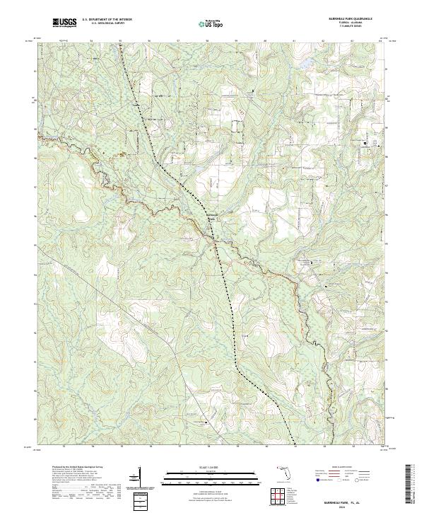
2024 Map of Barrineau Park
USGS Topo · Published 2024About this map
The Perdido River serves as a winding natural boundary between Florida and Alabama, defining the geography of this borderland region. Along its banks, the Perdido Canoe Trail - Section 1 and Perdido Canoe Trail - Section 2 trace the waterway through a landscape of dense creeks and branches, including Alligator Creek and Cowdevil Creek. Small rural settlements like Barrineau Park and Tenile anchor the local community, while a concentration of burial grounds such as Pughs Chapel Cem and Latham Chapel Cem provide significant touchstones for genealogists researching family lineages in Escambia and Baldwin Counties.
Find a feature on this map
89 named features on this map. Tap any name to fly to it.
Don’t see what you’re looking for? This feature index may not catch every label — zoom into the map to look around manually.
Map Details
Editions of this 2024 Barrineau Park Map
This is the sole edition of this map. No revisions or reprints were ever made.
Other maps of this area

1920 · Robertsdale
USGS Topo · 1:62,500

1921 · Muscogee
USGS Topo · 1:62,500

1941 · Muscogee
USGS Topo · 1:62,500

1941 · Robertsdale
USGS Topo · 1:62,500

1941 · Century
USGS Topo · 1:62,500

1942 · Dyas
USGS Topo · 1:62,500

1943 · Robertsdale
USGS Topo · 1:62,500

1943 · Muscogee
USGS Topo · 1:62,500

1943 · Century
USGS Topo · 1:62,500
1944 · Muscogee
USGS Topo · 1:25,000