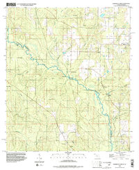
1994 Map of Barrineau Park
USGS Topo · Published 1999About this map
The Perdido River carves a meandering boundary between Florida and Alabama on this mid-1990s survey, defining the rural character of northern Baldwin and Escambia counties. Small settlements like Barrineau Park and Tenile serve as focal points for a landscape dominated by timber and extraction, evidenced by several sandpits and a claypit scattered near the water's edge. The distribution of rural life is captured through numerous small congregations, including St Elizabeth Ch, Latham Chapel, and Little Flock Ch, alongside the Barrineau Park Sch.
Find a feature on this map
31 named features on this map. Tap any name to fly to it.
Don’t see what you’re looking for? This feature index may not catch every label — zoom into the map to look around manually.
Map Details
Editions of this 1994 Barrineau Park Map
2 editions found
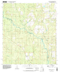
Other maps of this area

1920 · Robertsdale
USGS Topo · 1:62,500

1921 · Muscogee
USGS Topo · 1:62,500

1941 · Muscogee
USGS Topo · 1:62,500

1941 · Robertsdale
USGS Topo · 1:62,500

1941 · Century
USGS Topo · 1:62,500

1942 · Dyas
USGS Topo · 1:62,500

1943 · Robertsdale
USGS Topo · 1:62,500

1943 · Muscogee
USGS Topo · 1:62,500

1943 · Century
USGS Topo · 1:62,500
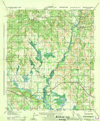
1944 · Muscogee
USGS Topo · 1:25,000