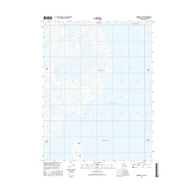
2016 Map of Barrow A-2 SW
USGS Topo · Published 2016About this map
Beaufort Sea waters dominate this coastal landscape on the edge of the Arctic, where the marine environment meets a low-lying tundra characteristic of the North Slope. The map illustrates a complex network of coastal features, most notably the Kikiktak Islands and the aptly named Tiny Island situated within the southern waters. On the mainland, Reindeer Lake sits amidst a pattern of wetlands and ephemeral water bodies that define the geomorphology of this remote region. The eastern portion of the sheet opens into Dease Inlet, showing the transition from protected coastal inlets to the open sea. This 2016 survey provides a precise look at the shoreline before further modern changes, documenting the exact positions of these islands and coastal indentations during a period of shifting Arctic geography.
Find a feature on this map
12 named features on this map. Tap any name to fly to it.
Don’t see what you’re looking for? This feature index may not catch every label — zoom into the map to look around manually.
Map Details
Editions of this 2016 Barrow A-2 SW Map
This is the sole edition of this map. No revisions or reprints were ever made.
Other maps of this area

1945 · Barrow
USGS Topo · 1:250,000

1949 · Barrow
USGS Topo · 1:250,000

1951 · Teshekpuk
USGS Topo · 1:250,000

1955 · Barrow A-2
USGS Topo · 1:63,360

1955 · Barrow
USGS Topo · 1:250,000

1955 · Teshekpuk
USGS Topo · 1:250,000

1955 · Barrow A-3
USGS Topo · 1:63,360
1955 · Teshekpuk D-5
USGS Topo · 1:63,360

1955 · Teshekpuk D-4
USGS Topo · 1:63,360

1964 · Teshekpuk
USGS Topo · 1:250,000