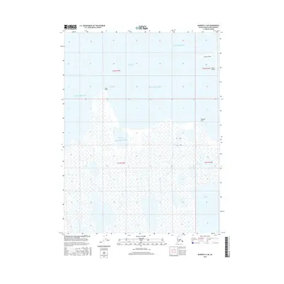
2016 Map of Barrow A-3 NE
USGS Topo · Published 2016About this map
Beaufort Sea waters dominate the northern horizon of this coastal survey, where the extreme edge of the North Slope meets the Arctic. The landscape is defined by the narrow barrier features of Cooper Island and the Plover Islands, which shield the sensitive inner waters of Elson Lagoon from the open sea. The map documents a complex aqueous environment of brackish inlets and tundra lakes, including the broad Ross Bay and the isolated Reindeer Lake. These features are connected by tidal passages like the Ekilukruak Entrance, illustrating the dynamic shoreline of this remote reach. Landforms such as Ross Point and Tulageak Point provide the few stable reference marks in a territory predominantly composed of wetlands and seasonal ice-scoured coasts.
Find a feature on this map
13 named features on this map. Tap any name to fly to it.
Don’t see what you’re looking for? This feature index may not catch every label — zoom into the map to look around manually.
Map Details
Editions of this 2016 Barrow A-3 NE Map
This is the sole edition of this map. No revisions or reprints were ever made.
Other maps of this area

1945 · Barrow
USGS Topo · 1:250,000

1949 · Barrow
USGS Topo · 1:250,000

1955 · Barrow A-2
USGS Topo · 1:63,360

1955 · Barrow
USGS Topo · 1:250,000

1955 · Barrow A-3
USGS Topo · 1:63,360
1955 · Barrow B-3
USGS Topo · 1:63,360
2016 · Barrow A-3 SE
USGS Topo · 1:25,000
2016 · Barrow A-2 SW
USGS Topo · 1:25,000
2016 · Barrow A-3 SW
USGS Topo · 1:25,000
2016 · Barrow A-2 NW
USGS Topo · 1:25,000