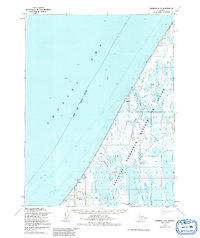
1955 Map of Barrow A-5
USGS Topo · Published 1992About this map
The Will Rogers and Wiley Post Memorial stands on this Arctic coastline, marking the site where the famed aviators' flight ended. This 1955 survey of the Chukchi Sea coast reveals a landscape of tundra and water, where seasonal mobility was defined by the Winter Trail. Small settlements like Nulavik and Nan appear alongside isolated survival structures, including a designated Shelter and a point labeled Help, reflecting the precarious nature of life in the high Arctic.
Find a feature on this map
16 named features on this map. Tap any name to fly to it.
Don’t see what you’re looking for? This feature index may not catch every label — zoom into the map to look around manually.
Map Details
Editions of this 1955 Barrow A-5 Map
3 editions found
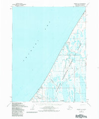
Other maps of this area

1945 · Barrow
USGS Topo · 1:250,000

1949 · Barrow
USGS Topo · 1:250,000

1951 · Meade River
USGS Topo · 1:250,000

1955 · Barrow
USGS Topo · 1:250,000

1955 · Barrow B-4
USGS Topo · 1:63,360

1955 · Meade River
USGS Topo · 1:250,000

1955 · Barrow A-4
USGS Topo · 1:63,360

1955 · Barrow A-5
USGS Topo · 1:63,360

1955 · Meade River D-2
USGS Topo · 1:63,360

1955 · Meade River D-3
USGS Topo · 1:63,360