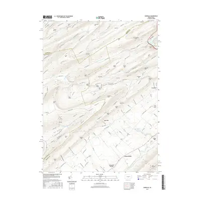
2016 Map of Barrville
USGS Topo · Published 2016About this map
Barrville and Alexander Springs lie at the transition from the steep ridges of the Seven Mountains to the valley floor in Mifflin and Huntingdon Counties. This 2016 survey highlights a complex network of forest roads and hiking paths, such as the John Wert Trail and Tussey Mountain Trail, crossing through high points like Thickhead Mtn and Stone Mtn. The landscape is defined by its numerous gaps and kettles, including Treaster Kettle and Polyann Gap, which have historically dictated the movement of travelers and water through the region. Down in the valley, the Mifflin County Airport and small settlements like Kishacoquillas sit near the winding Kishacoquillas Creek. Local genealogy is anchored by sites such as Hooleys Cem and Long Lane Cem, which offer physical connections to the area's early residents.
Find a feature on this map
141 named features on this map. Tap any name to fly to it.
Don’t see what you’re looking for? This feature index may not catch every label — zoom into the map to look around manually.
Map Details
Editions of this 2016 Barrville Map
This is the sole edition of this map. No revisions or reprints were ever made.
Other maps of this area

1908 · Bellefonte
USGS Topo · 1:62,500

1909 · Bellefonte
USGS Topo · 1:62,500

1919 · Menno
USGS Topo · 1:62,500

1924 · Centre Hall
USGS Topo · 1:62,500

1924 · Lewistown
USGS Topo · 1:62,500

1927 · Lewisburg
USGS Topo · 1:62,500

1929 · Centre Hall
USGS Topo · 1:62,500

1935 · Allensville
USGS Topo · 1:62,500

1938 · Allensville
USGS Topo · 1:62,500

1943 · Lewistown
USGS Topo · 1:125,000
Featured Places
- Granville Township, PA
- Kishacoquillas, Brown Township
- Harris Township, PA
- Barrville, Brown Township
- Reedsville, Brown Township