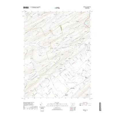
2019 Map of Barrville
USGS Topo · Published 2019About this map
Barrville and the surrounding agricultural valleys of Mifflin County appear in high detail on this contemporary survey, showing a landscape defined by sharp mountain ridges and deep hollows. The map traces the rugged topography of the Ridge-and-Valley Appalachians, where features like Big Kettle, Treaster Kettle, and Rag Hollow reveal the complex local geography. Several small family and community burial grounds, including the Barryville Mennonite Cem and Yoder Zook Cem, are documented here, providing valuable data for genealogists tracking lineages in this rural stretch of Pennsylvania. The transition from the high, wooded slopes of Stone Mountain and Broad Mountain to the flat expanse of the Kishacoquillas Valley illustrates the region's historic land-use patterns, from timbered heights to valley floor farming. Modern infrastructure is also present, notably the Mifflin County Airport and the network of forest roads and trails such as the Tussey Mountain Trail.
Find a feature on this map
143 named features on this map. Tap any name to fly to it.
Don’t see what you’re looking for? This feature index may not catch every label — zoom into the map to look around manually.
Map Details
Editions of this 2019 Barrville Map
This is the sole edition of this map. No revisions or reprints were ever made.
Other maps of this area

1908 · Bellefonte
USGS Topo · 1:62,500

1909 · Bellefonte
USGS Topo · 1:62,500

1919 · Menno
USGS Topo · 1:62,500

1924 · Centre Hall
USGS Topo · 1:62,500

1924 · Lewistown
USGS Topo · 1:62,500

1927 · Lewisburg
USGS Topo · 1:62,500

1929 · Centre Hall
USGS Topo · 1:62,500

1935 · Allensville
USGS Topo · 1:62,500

1938 · Allensville
USGS Topo · 1:62,500

1943 · Lewistown
USGS Topo · 1:125,000
Featured Places
- Granville Township, PA
- Kishacoquillas, Brown Township
- Harris Township, PA
- Barrville, Brown Township
- Reedsville, Brown Township