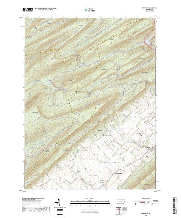
2023 Map of Barrville
USGS Topo · Published 2023About this map
Barrville and the broader Kishacoquillas Valley are defined by a rhythmic series of ridges and gaps in this central Pennsylvania landscape. The map shows a clear division between the high, forest-covered terrain of the Rothrock State Forest and the fertile, settled floor of the valley. Notable landmarks like Milligans Knob and Thickhead Mountain dominate the north, while the agricultural lowlands are dotted with community landmarks such as the Barrville Mennonite Cem and Yoder Zook Cem.
Find a feature on this map
122 named features on this map. Tap any name to fly to it.
Don’t see what you’re looking for? This feature index may not catch every label — zoom into the map to look around manually.
Map Details
Editions of this 2023 Barrville Map
This is the sole edition of this map. No revisions or reprints were ever made.
Historical Maps of Union Township Through Time
4 maps found