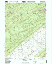
1998 Map of Barrville
USGS Topo · Published 1999About this map
Barrville and the agricultural lands of the Kishacoquillas Valley dominate the southern half of this landscape, where the rural character of Mifflin County is defined by its limestone-rich valley floor and high mountain ridges. To the north, the terrain rises sharply into the high elevations of the Bald Eagle State Forest and Rothrock State Forest, featuring dense networks of forest roads and trails like Sand Road and Crowfield Trail. This area includes significant conservation landmarks such as the Thickhead Wild Area and Alan Seeger Natural Area, highlighting a region where natural resource management and isolated mountain hollows have historically existed alongside the valley's farms.
Find a feature on this map
80 named features on this map. Tap any name to fly to it.
Don’t see what you’re looking for? This feature index may not catch every label — zoom into the map to look around manually.
Map Details
Editions of this 1998 Barrville Map
This is the sole edition of this map. No revisions or reprints were ever made.
Other maps of this area

1908 · Bellefonte
USGS Topo · 1:62,500

1909 · Bellefonte
USGS Topo · 1:62,500

1919 · Menno
USGS Topo · 1:62,500

1924 · Centre Hall
USGS Topo · 1:62,500

1924 · Lewistown
USGS Topo · 1:62,500

1927 · Lewisburg
USGS Topo · 1:62,500

1929 · Centre Hall
USGS Topo · 1:62,500

1935 · Allensville
USGS Topo · 1:62,500

1938 · Allensville
USGS Topo · 1:62,500

1943 · Lewistown
USGS Topo · 1:125,000
Featured Places
- Granville Township, PA
- Jackson Township, PA
- Brown Township, PA
- Reedsville, Brown Township
- Kishacoquillas, Brown Township