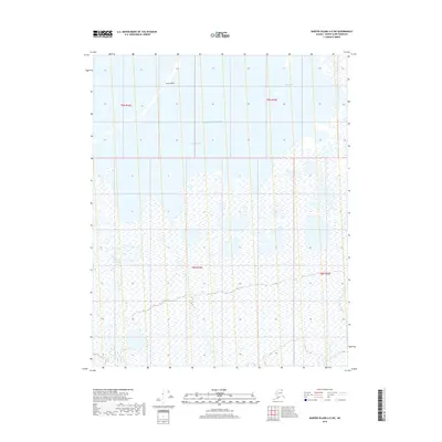
2018 Map of Barter Island A-5 SW
USGS Topo · Published 2018About this map
Arey Island and the shallow waters of Arey Lagoon dominate this coastal section of the North Slope, where the land meets the Beaufort Sea. This 2018 survey documents a dynamic arctic shoreline defined by shifting barrier islands and narrow tidal openings like the Kuuritovik Entrance. Inland, the geography is characterized by an intricate network of wetlands and tundra ponds, with the Okpilak River meandering toward the coast along the western boundary. The map provides a precise record of the hydrological patterns and township boundaries within T9N and T8N as they existed during the early 21st century, offering essential data for those studying the environmental changes of the Alaskan arctic coast.
Find a feature on this map
9 named features on this map. Tap any name to fly to it.
Don’t see what you’re looking for? This feature index may not catch every label — zoom into the map to look around manually.
Map Details
Editions of this 2018 Barter Island A-5 SW Map
This is the sole edition of this map. No revisions or reprints were ever made.
Other maps of this area

1951 · Barter Island
USGS Topo · 1:250,000

1951 · Demarcation Point
USGS Topo · 1:250,000

1951 · Mt. Michelson
USGS Topo · 1:250,000

1955 · Flaxman Island
USGS Topo · 1:250,000

1955 · Demarcation Point
USGS Topo · 1:250,000

1955 · Flaxman Island A-1
USGS Topo · 1:63,360

1955 · Barter Island A-5
USGS Topo · 1:63,360

1955 · Mount Michelson D-1
USGS Topo · 1:63,360

1955 · Demarcation Point D-5
USGS Topo · 1:63,360

1956 · Mt. Michelson
USGS Topo · 1:250,000