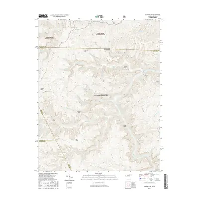
2016 Map of Barthell SW
USGS Topo · Published 2016About this map
The Big South Fork Cumberland River carves a deep path through the borderlands of Tennessee and Kentucky, anchoring a landscape defined by significant topographic relief and protected wilderness. This 2016 survey highlights the intersection of the Daniel Boone National Forest and the Big South Fork National River and Recreation Area, where intricate drainage systems like No Business Cr and Parch Corn Cr feed into the central waterway. Genealogists and local historians can locate remote family landmarks such as Terry Cem and Slavens Cem, situated on high ground away from the river’s edge. The map captures the prominent geologic formations of the region, specifically the Twin Arches, and traces the high elevation points of Hatfield Ridge and Fork Ridge that dictate the area's movement and historical settlement patterns.
Find a feature on this map
71 named features on this map. Tap any name to fly to it.
Don’t see what you’re looking for? This feature index may not catch every label — zoom into the map to look around manually.
Map Details
Editions of this 2016 Barthell SW Map
This is the sole edition of this map. No revisions or reprints were ever made.
Other maps of this area

1895 · Wartburg
USGS Topo · 1:125,000

1896 · Wartburg
USGS Topo · 1:125,000

1934 · Barthell
USGS Topo · 1:62,500

1934 · Pall Mall
USGS Topo · 1:62,500

1952 · Helenwood
USGS Topo · 1:24,000

1952 · Honey Creek
USGS Topo · 1:24,000

1954 · Stockton
USGS Topo · 1:24,000

1954 · Parmleysville
USGS Topo · 1:24,000
1954 · Barthell
USGS Topo · 1:24,000

1954 · Bell Farm
USGS Topo · 1:24,000