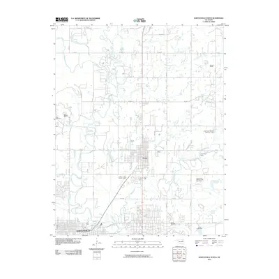
2010 Map of Bartlesville North
USGS Topo · Published 2010About this map
The Caney River and its tributary, the Little Caney River, define the low-lying drainage patterns of this northern Oklahoma landscape as it appeared in the early 21st century. The map centers on the sister cities of Dewey and the northern reaches of Bartlesville, illustrating the dense grid-patterned growth of these settlements. Local topography is punctuated by prominent landmarks such as The Mound in the southwest and Limestone Draw to the east.
Find a feature on this map
36 named features on this map. Tap any name to fly to it.
Don’t see what you’re looking for? This feature index may not catch every label — zoom into the map to look around manually.
Map Details
Editions of this 2010 Bartlesville North Map
This is the sole edition of this map. No revisions or reprints were ever made.
Other maps of this area

1901 · Nowata
USGS Topo · 1:125,000

1909 · Pawhuska
USGS Topo · 1:125,000

1910 · Pawhuska
USGS Topo · 1:125,000

1914 · Nowata
USGS Topo · 1:125,000

1954 · Tulsa
USGS Topo · 1:250,000

1955 · Enid
USGS Topo · 1:250,000

1958 · Enid
USGS Topo · 1:250,000

1958 · Tulsa
USGS Topo · 1:250,000

1963 · Tulsa
USGS Topo · 1:250,000
1971 · Bowring
USGS Topo · 1:24,000