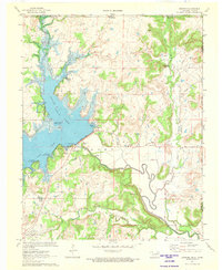
1971 Map of Bowring
USGS Topo · Published 1973About this map
Hulah Lake dominates this northern Osage County landscape, created by the damming of the Caney River near the small community of Hulah. The reservoir's irregular shoreline is defined by numerous inlets like Tucker Cove and Quarry Cove, while its western reaches are fed by Hickory Creek and Thunderbolt Creek. The mapping reveals a transition in land use, where rugged terrain such as Oak Ridge and Sundown Hill meets the industrialized infrastructure of Oil Wells and a Pumping Station.
Find a feature on this map
36 named features on this map. Tap any name to fly to it.
Don’t see what you’re looking for? This feature index may not catch every label — zoom into the map to look around manually.
Map Details
Editions of this 1971 Bowring Map
This is the sole edition of this map. No revisions or reprints were ever made.
Other maps of this area

1885 · Sedan
USGS Topo · 1:125,000

1886 · Independence
USGS Topo · 1:125,000

1889 · Sedan
USGS Topo · 1:125,000

1894 · Independence
USGS Topo · 1:125,000

1901 · Nowata
USGS Topo · 1:125,000

1905 · Independence
USGS Topo · 1:125,000

1909 · Pawhuska
USGS Topo · 1:125,000

1910 · Pawhuska
USGS Topo · 1:125,000

1914 · Nowata
USGS Topo · 1:125,000

1947 · Joplin
USGS Topo · 1:250,000