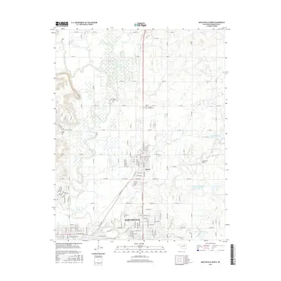
2016 Map of Bartlesville North
USGS Topo · Published 2016About this map
The Caney River and Little Caney River converge in this northern reach of the Cross Timbers, where the urban edge of Bartlesville transitions into the town of Dewey. This area is particularly rich in genealogical data, preserving several distinct burial grounds including the Delaware Cem, Beck Cem, and the Dewey Negro Cem. The landscape is defined by a series of reservoirs and creek systems, such as Paul Mitchell Reservoir and the uniquely named Cotton-Coon-Mission Creek Site 15 Reservoir. These water management features, along with Limestone Draw, suggest the ongoing efforts to manage the watershed surrounding these established Oklahoma communities. The dense grid of county roads, including W 1000 Rd and Bar Dew Lake Rd, provides a clear view of the rural-to-urban development pattern at the mid-2010s.
Find a feature on this map
66 named features on this map. Tap any name to fly to it.
Don’t see what you’re looking for? This feature index may not catch every label — zoom into the map to look around manually.
Map Details
Editions of this 2016 Bartlesville North Map
This is the sole edition of this map. No revisions or reprints were ever made.
Other maps of this area

1901 · Nowata
USGS Topo · 1:125,000

1909 · Pawhuska
USGS Topo · 1:125,000

1910 · Pawhuska
USGS Topo · 1:125,000

1914 · Nowata
USGS Topo · 1:125,000

1954 · Tulsa
USGS Topo · 1:250,000

1955 · Enid
USGS Topo · 1:250,000

1958 · Enid
USGS Topo · 1:250,000

1958 · Tulsa
USGS Topo · 1:250,000

1963 · Tulsa
USGS Topo · 1:250,000
1971 · Bowring
USGS Topo · 1:24,000