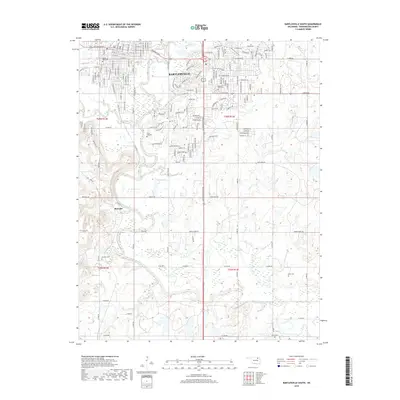
2019 Map of Bartlesville South
USGS Topo · Published 2019About this map
Bartlesville and its southern suburban expansion dominate the northern landscape of this region, where the Caney River and Turkey Cr define the drainage patterns. The southern reaches of the city give way to more rural territory characterized by numerous small tributaries like Eliza Cr, Coon Creek, and Fish Cr. For those tracing local history, several distinct cemeteries are documented, including White Rose Cem, Memorial Park Cem, and the more rural Keyes Cem to the south. The small settlement of Matoaka sits west of the river, while the community of Limestone is situated along the eastern corridor. The terrain shows a mixture of dense residential grids near the city center and larger land tracts defined by section lines and named rural roads such as Rice Creek Rd and State Barn Rd.
Find a feature on this map
52 named features on this map. Tap any name to fly to it.
Don’t see what you’re looking for? This feature index may not catch every label — zoom into the map to look around manually.
Map Details
Editions of this 2019 Bartlesville South Map
This is the sole edition of this map. No revisions or reprints were ever made.
Other maps of this area

1901 · Nowata
USGS Topo · 1:125,000

1909 · Pawhuska
USGS Topo · 1:125,000

1910 · Pawhuska
USGS Topo · 1:125,000

1914 · Nowata
USGS Topo · 1:125,000

1954 · Tulsa
USGS Topo · 1:250,000

1955 · Enid
USGS Topo · 1:250,000

1958 · Enid
USGS Topo · 1:250,000

1958 · Tulsa
USGS Topo · 1:250,000

1963 · Tulsa
USGS Topo · 1:250,000

1970 · Bartlesville SE
USGS Topo · 1:24,000