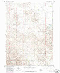
1954 Map of Bartlett NW
USGS Topo · Published 1985About this map
Buffalo Flats dominates the northern expanse of this Wheeler County terrain, illustrating the characteristic topography of the Nebraska sandhills. This survey, based on aerial photography from the early 1950s, documents a landscape defined by localized depressions and intermittent water features typical of the Missouri River Basin development area. While primarily an open grazing territory, the map records the specific location of the Griffin Ridge Sch in the southern portion, serving as a vital landmark for local genealogy and the history of rural education in the region. Infrastructure is sparse, marked largely by an occasional Windmill providing water for livestock, reflecting the enduring ranching economy that shaped these plains. The 1980s photorevisions highlight subtle changes in woodland cover, contrasting the mid-century field conditions with later environmental shifts.
Find a feature on this map
3 named features on this map. Tap any name to fly to it.
Don’t see what you’re looking for? This feature index may not catch every label — zoom into the map to look around manually.
Map Details
Editions of this 1954 Bartlett NW Map
2 editions found
Other maps of this area

1954 · Gables SE
USGS Topo · 1:24,000

1954 · Bartlett NW
USGS Topo · 1:24,000

1954 · Bartlett SE
USGS Topo · 1:24,000

1954 · Bartlett
USGS Topo · 1:24,000

1954 · Ericson
USGS Topo · 1:24,000

1954 · Gables
USGS Topo · 1:24,000

1955 · Broken Bow
USGS Topo · 1:250,000

1955 · O'Neill
USGS Topo · 1:250,000

1956 · Broken Bow
USGS Topo · 1:250,000

1959 · O'Neill
USGS Topo · 1:250,000