
1954 Map of Bartlett SE
USGS Topo · Published 1956About this map
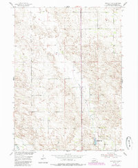
The rolling Sandhills of Wheeler County are defined by a network of rural schoolhouses and localized water resources in this mid-1950s survey. Education was decentralized across the township, as evidenced by the distribution of Highway Sch, Clear Creek Sch, and Four Corners Sch. The southeastern corner of the map features the Pibel Lake Recreational Area, a focal point for the community centered around Pibel Lake. Nearby, the Pibel Sch and Pibel Cem suggest a historical neighborhood cluster that served the surrounding farmsteads. The landscape is drained by Clear Creek and Cedar Cr, with the broad depression of Mud Creek spanning the eastern portion. The map captures the region during the Department of the Interior’s Missouri River Basin development program, documenting a quiet era of Nebraska ranching and agrarian life before significant modern consolidation.
Find a feature on this map
12 named features on this map. Tap any name to fly to it.
Don’t see what you’re looking for? This feature index may not catch every label — zoom into the map to look around manually.
Map Details
Editions of this 1954 Bartlett SE Map
2 editions found
Other maps of this area

1954 · Greeley NE
USGS Topo · 1:24,000

1954 · Greeley NW
USGS Topo · 1:24,000

1954 · Bartlett NW
USGS Topo · 1:24,000

1954 · Spalding NW
USGS Topo · 1:24,000

1954 · Bartlett
USGS Topo · 1:24,000

1954 · Ericson
USGS Topo · 1:24,000

1955 · Broken Bow
USGS Topo · 1:250,000

1956 · Broken Bow
USGS Topo · 1:250,000

1960 · Spalding 2 SW
USGS Topo · 1:24,000

1960 · Spalding 2 NW
USGS Topo · 1:24,000