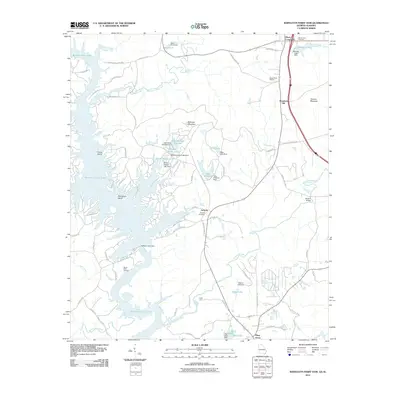
2011 Map of Bartletts Ferry Dam
USGS Topo · Published 2011About this map
Bartletts Ferry Dam anchors this landscape, holding back the waters of Bartletts Ferry Lake as it straddles the Georgia-Alabama border. The shoreline is punctuated by local landmarks like Cooks Island, Herrington Island, and the Sandy Point Landing, reflecting the area's development for recreation and power generation. In the interior, small settlements such as Antioch and Mountain Hill are connected by a network of winding roads, including Lick Skillet Rd and Happy Hollow Rd.
Find a feature on this map
84 named features on this map. Tap any name to fly to it.
Don’t see what you’re looking for? This feature index may not catch every label — zoom into the map to look around manually.
Map Details
Editions of this 2011 Bartletts Ferry Dam Map
This is the sole edition of this map. No revisions or reprints were ever made.
Other maps of this area

1907 · Talbotton
USGS Topo · 1:125,000

1907 · Opelika
USGS Topo · 1:125,000

1909 · Opelika
USGS Topo · 1:125,000

1950 · Fortson
USGS Topo · 1:24,000

1950 · Mulberry Grove
USGS Topo · 1:24,000

1950 · Ellerslie
USGS Topo · 1:62,500
1955 · Mulberry Grove
USGS Topo · 1:24,000
1955 · Fortson
USGS Topo · 1:24,000
1955 · Ellerslie
USGS Topo · 1:62,500

1955 · Phenix City
USGS Topo · 1:250,000