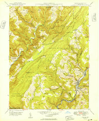
1949 Map of Barton
USGS Topo · Published 1949About this map
Savage Mountain and the deep valleys of the Savage River State Forest dominate this post-war landscape in western Maryland. The settlement pattern is concentrated along the eastern edge where Georges Creek flows through the coal and industrial corridor, connecting towns like Barton, Moscow, and Pekin Nikep PO. This area shows a clear divide between the high, timbered ridges of the Savage River watershed and the more densely populated valley floor.
Find a feature on this map
63 named features on this map. Tap any name to fly to it.
Don’t see what you’re looking for? This feature index may not catch every label — zoom into the map to look around manually.
Map Details
Editions of this 1949 Barton Map
2 editions found
Other maps of this area

1891 · Romney
USGS Topo · 1:125,000

1895 · Piedmont
USGS Topo · 1:125,000

1898 · Frostburg
USGS Topo · 1:62,500

1899 · Grantsville
USGS Topo · 1:62,500

1901 · Frostburg
USGS Topo · 1:62,500

1904 · Grantsville
USGS Topo · 1:62,500

1908 · Frostburg
USGS Topo · 1:62,500

1919 · Elk Garden
USGS Topo · 1:48,000

1920 · Elk Garden
USGS Topo · 1:48,000

1920 · Keyser
USGS Topo · 1:62,500