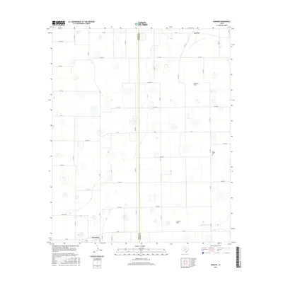
2016 Map of Barwise
USGS Topo · Published 2016About this map
The intersection of Hale and Floyd counties in the Texas Panhandle anchors this study of agricultural land use and ephemeral hydrology. The northern portion of Petersburg sits at the southwestern corner, while the small community of Barwise is located at the northern boundary. The landscape is defined by its drainage patterns, notably Callahan Draw and Crawfish Draw, which lead toward the intermittent waters of Crawfish Cr. A network of farm-to-market roads, including FM 784, FM 789, and FM 54, provides the infrastructure for this rural region. Genealogists and local historians will find the Carrs Chapel Cem near FM 378, a significant landmark for the surrounding families. The map illustrates the grid-like precision of Texas county roads, reflecting the systematic settlement and ranching development of the High Plains.
Find a feature on this map
41 named features on this map. Tap any name to fly to it.
Don’t see what you’re looking for? This feature index may not catch every label — zoom into the map to look around manually.
Map Details
Editions of this 2016 Barwise Map
This is the sole edition of this map. No revisions or reprints were ever made.
Other maps of this area

1954 · Lubbock
USGS Topo · 1:250,000

1954 · Plainview
USGS Topo · 1:250,000

1958 · Plainview
USGS Topo · 1:250,000

1965 · Petersburg
USGS Topo · 1:24,000

1965 · Heckville
USGS Topo · 1:24,000

1965 · Cone
USGS Topo · 1:24,000

1965 · Lockney
USGS Topo · 1:24,000

1965 · Sandhill
USGS Topo · 1:24,000

1968 · Happy Union
USGS Topo · 1:24,000

1968 · Barwise
USGS Topo · 1:24,000