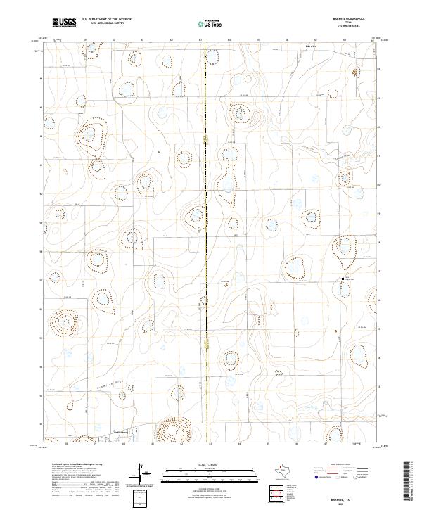
2022 Map of Barwise
USGS Topo · Published 2022About this map
The agrarian plains of the High Plains are defined here by the boundary of Hale Co and Floyd Co, where the landscape is etched by seasonal drainage patterns and a strictly organized grid of county roads. The settlement of Petersburg occupies the southwestern corner, serving as a primary hub for this farming region. Further north, the smaller community of Barwise marks the intersection of FM 784 and Co RD 39, illustrating the typical West Texas pattern of widely spaced rural centers.
Find a feature on this map
43 named features on this map. Tap any name to fly to it.
Don’t see what you’re looking for? This feature index may not catch every label — zoom into the map to look around manually.
Map Details
Editions of this 2022 Barwise Map
This is the sole edition of this map. No revisions or reprints were ever made.
Other maps of this area

1954 · Lubbock
USGS Topo · 1:250,000

1954 · Plainview
USGS Topo · 1:250,000

1958 · Plainview
USGS Topo · 1:250,000

1965 · Petersburg
USGS Topo · 1:24,000

1965 · Heckville
USGS Topo · 1:24,000

1965 · Cone
USGS Topo · 1:24,000

1965 · Lockney
USGS Topo · 1:24,000

1965 · Sandhill
USGS Topo · 1:24,000

1968 · Happy Union
USGS Topo · 1:24,000

1968 · Barwise
USGS Topo · 1:24,000