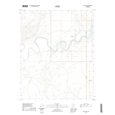
2020 Map of Bascom Camp
USGS Topo · Published 2020About this map
The meandering course of the Canadian River dominates this portion of the New Mexico landscape, winding through the canyons of San Miguel County. Near the center of the sheet lies Bascom Camp, situated at a sharp bend in the river valley. To the east, the waters widen into the upper reaches of the Ute Reservoir, where the county line separates San Miguel from Quay County. The drainage network is further defined by Pajarito Creek and Cuervos Cr, which carve through the high plains to meet the main river channel. This 2020 survey illustrates the remote character of the region, where infrastructure is limited to secondary routes like Qr 72 and ranch roads that navigate the complex topography of the Canadian River breaks.
Find a feature on this map
8 named features on this map. Tap any name to fly to it.
Don’t see what you’re looking for? This feature index may not catch every label — zoom into the map to look around manually.
Map Details
Editions of this 2020 Bascom Camp Map
This is the sole edition of this map. No revisions or reprints were ever made.
Other maps of this area

1930 · Tucumcari
USGS Topo · 1:125,000

1954 · Tucumcari
USGS Topo · 1:250,000

1958 · Tucumcari
USGS Topo · 1:250,000

1967 · Trinchera Creek
USGS Topo · 1:24,000

1967 · Liberty Mesa
USGS Topo · 1:24,000

1967 · Tucumcari
USGS Topo · 1:24,000

1968 · Bascom Camp
USGS Topo · 1:24,000

1968 · Hampton Ranch
USGS Topo · 1:24,000

1968 · Hudson
USGS Topo · 1:24,000

1968 · Lesbia
USGS Topo · 1:24,000