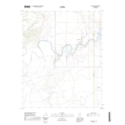
2023 Map of Bascom Camp
USGS Topo · Published 2023About this map
The Canadian River meanders through the high plains of East-Central New Mexico, carving a prominent valley across the landscape. This modern survey illustrates the hydrology of the region as it transitions into the western edge of the Ute Reservoir. The confluence of several drainage systems, including Pajarito Creek and Carcas Creek, defines the area's geography. The map also delineates the jurisdictional boundary between San Miguel Co and Quay Co, providing a clear view of how these remote lands are organized within the Public Land Survey System, specifically across Township 13 North, Range 31 East and Township 12 North, Range 31 East.
Find a feature on this map
7 named features on this map. Tap any name to fly to it.
Don’t see what you’re looking for? This feature index may not catch every label — zoom into the map to look around manually.
Map Details
Editions of this 2023 Bascom Camp Map
This is the sole edition of this map. No revisions or reprints were ever made.
Other maps of this area

1930 · Tucumcari
USGS Topo · 1:125,000

1954 · Tucumcari
USGS Topo · 1:250,000

1958 · Tucumcari
USGS Topo · 1:250,000

1967 · Trinchera Creek
USGS Topo · 1:24,000

1967 · Liberty Mesa
USGS Topo · 1:24,000

1967 · Tucumcari
USGS Topo · 1:24,000

1968 · Bascom Camp
USGS Topo · 1:24,000

1968 · Hampton Ranch
USGS Topo · 1:24,000

1968 · Hudson
USGS Topo · 1:24,000

1968 · Lesbia
USGS Topo · 1:24,000