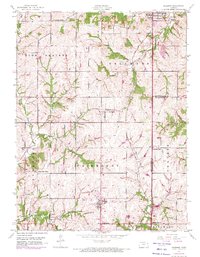
1950 Map of Basehor
USGS Topo · Published 1971About this map
Lansing and the massive Kansas State Penitentiary complex anchor the northeastern corner of this landscape, marking a significant center of institutional development in Leavenworth County. Moving south and west, the terrain transitions into the agricultural heartland of High Prairie and Fairmount, where a dense network of country schools like Timber Ridge School and Brauer Sch once served rural families. The 1970 revisions, shown in purple, reveal the expansion of Basehor and South Basehor as suburban growth began to reach into these farming districts.
Find a feature on this map
36 named features on this map. Tap any name to fly to it.
Don’t see what you’re looking for? This feature index may not catch every label — zoom into the map to look around manually.
Map Details
Editions of this 1950 Basehor Map
3 editions found
Other maps of this area

1886 · Oskaloosa
USGS Topo · 1:125,000

1888 · Oskaloosa
USGS Topo · 1:125,000

1890 · Kansas City
USGS Topo · 1:125,000

1894 · Kansas City
USGS Topo · 1:125,000

1894 · Oskaloosa
USGS Topo · 1:125,000

1910 · Leavenworth
USGS Topo · 1:62,500

1934 · Bonner Springs
USGS Topo · 1:48,000

1934 · Edwardsville
USGS Topo · 1:24,000

1934 · Wolcott
USGS Topo · 1:24,000

1940 · Bonner Springs
USGS Topo · 1:62,500