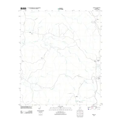
2011 Map of Bashi
USGS Topo · Published 2011About this map
Bashi Creek and its many tributaries, including Johnson Creek and Horse Creek, define the rural landscape of Clarke County in this early 21st-century study. The region is characterized by small, dispersed settlements such as Bashi, Glover, and Choctaw Corner, which are connected by a network of winding local roads like Bashi Rd and Tallahatta Springs Rd. Genealogists will find several burial grounds noted, including the Bethel Cemetery in the northeast and the Choctaw Corner Cemetery to the east. The southern portion of the map is shaped by the drainage of Tallahatta Creek and Bassett Creek, where the J D Phillips Lake Dam creates a small reservoir. The presence of McFadden Memorial Gardens near the eastern border provides further points of interest for local history researchers tracking community growth and land use in this part of Alabama.
Find a feature on this map
40 named features on this map. Tap any name to fly to it.
Don’t see what you’re looking for? This feature index may not catch every label — zoom into the map to look around manually.
Map Details
Editions of this 2011 Bashi Map
This is the sole edition of this map. No revisions or reprints were ever made.
Other maps of this area

1953 · Montgomery
USGS Topo · 1:250,000

1953 · Andalusia
USGS Topo · 1:250,000

1956 · Montgomery
USGS Topo · 1:250,000

1957 · Montgomery
USGS Topo · 1:250,000

1957 · Andalusia
USGS Topo · 1:250,000

1973 · Fulton East
USGS Topo · 1:24,000

1973 · Thomasville
USGS Topo · 1:24,000

1978 · Surginer
USGS Topo · 1:24,000

1978 · Sweet Water
USGS Topo · 1:24,000

1978 · McEntyre
USGS Topo · 1:24,000