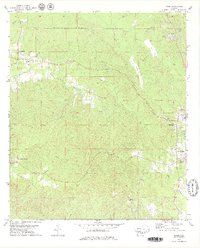
1978 Map of Bashi
USGS Topo · Published 1979About this map
The Old Indian Treaty Boundary carves a diagonal path through this 1970s landscape, serving as a historical demarcation between Marengo and Clarke Counties. The topography is defined by an intricate network of waterways, including Bashi Creek, Tallahatta Creek, and Satilpa Creek, which drainage patterns have long influenced local settlement. To the east, Thomasville emerges as a primary hub, featuring the Thomasville Academy and McFadden Memorial Gardens.
Find a feature on this map
26 named features on this map. Tap any name to fly to it.
Don’t see what you’re looking for? This feature index may not catch every label — zoom into the map to look around manually.
Map Details
Editions of this 1978 Bashi Map
2 editions found
Other maps of this area

1953 · Montgomery
USGS Topo · 1:250,000

1953 · Andalusia
USGS Topo · 1:250,000

1956 · Montgomery
USGS Topo · 1:250,000

1957 · Montgomery
USGS Topo · 1:250,000

1957 · Andalusia
USGS Topo · 1:250,000

1973 · Fulton East
USGS Topo · 1:24,000

1973 · Thomasville
USGS Topo · 1:24,000

1978 · Surginer
USGS Topo · 1:24,000

1978 · Sweet Water
USGS Topo · 1:24,000

1978 · McEntyre
USGS Topo · 1:24,000