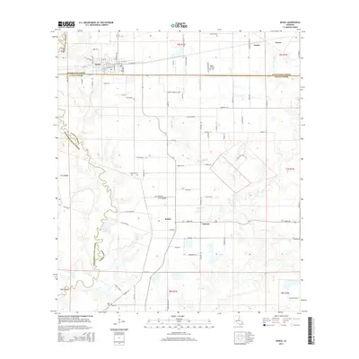
2015 Map of Basile
USGS Topo · Published 2015About this map
The town of Basile anchors the northwest corner of this prairie and bayou landscape, where the traditional land divisions of the Louisiana countryside meet the modern agricultural grid. This survey marks the intersection of Evangeline Parish, Acadia Parish, and Jefferson Davis Parish, illustrating a complex network of rural roads such as W Railroad St and Alfa Romeo Rd. The terrain is defined by slow-moving waterways like Bayou Barwick and Berwick Cr, which snake through the flatlands toward Mitchell Lake.
Find a feature on this map
47 named features on this map. Tap any name to fly to it.
Don’t see what you’re looking for? This feature index may not catch every label — zoom into the map to look around manually.
Map Details
Editions of this 2015 Basile Map
This is the sole edition of this map. No revisions or reprints were ever made.
Other maps of this area

1947 · Evangeline
USGS Topo · 1:31,680

1947 · Fruge Lake
USGS Topo · 1:31,680

1947 · Redland
USGS Topo · 1:31,680

1947 · Elton
USGS Topo · 1:31,680

1947 · Eunice
USGS Topo · 1:31,680

1947 · Hathaway
USGS Topo · 1:31,680

1947 · Iota
USGS Topo · 1:31,680

1947 · Basile
USGS Topo · 1:31,680

1949 · Bayou Blue
USGS Topo · 1:31,680

1949 · Basile
USGS Topo · 1:31,680