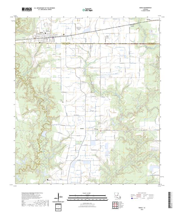
2024 Map of Basile
USGS Topo · Published 2024About this map
Basile serves as the primary hub of this Southwest Louisiana landscape, where the agricultural traditions of the prairie meet the drainage networks of the gulf coastal plain. The town's grid is established north of the parish line, featuring a cluster of local landmarks including the Saint Augustine Catholic Cem and Assumption Cem. The surrounding countryside is defined by its aviation and water history, with Lejeune Aerial Applications Airport and Millers Flying Service supporting the local rice and crawfish industry. Small settlements like Tepetate, Redich, and Unatex are scattered across the terrain, linked by a dense network of local roads such as Tee Mamou Rd and Beau Chene Rd. The map meticulously details the meandering courses of Bayou Barwick and Berwick Creek, which cut through the level fields and timbered draws that define this section of the Acadiana region.
Find a feature on this map
61 named features on this map. Tap any name to fly to it.
Don’t see what you’re looking for? This feature index may not catch every label — zoom into the map to look around manually.
Map Details
Editions of this 2024 Basile Map
This is the sole edition of this map. No revisions or reprints were ever made.
Other maps of this area

1947 · Evangeline
USGS Topo · 1:31,680

1947 · Fruge Lake
USGS Topo · 1:31,680

1947 · Redland
USGS Topo · 1:31,680

1947 · Elton
USGS Topo · 1:31,680

1947 · Eunice
USGS Topo · 1:31,680

1947 · Hathaway
USGS Topo · 1:31,680

1947 · Iota
USGS Topo · 1:31,680

1947 · Basile
USGS Topo · 1:31,680

1949 · Bayou Blue
USGS Topo · 1:31,680

1949 · Basile
USGS Topo · 1:31,680