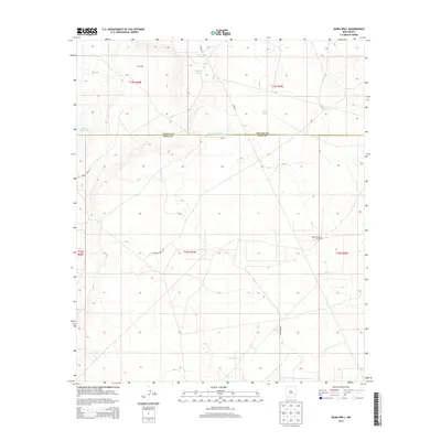
2013 Map of Basin Well
USGS Topo · Published 2013About this map
Basin Well sits at the heart of this high desert landscape on the border of Chaves and Eddy counties. The terrain is defined by its sparse water infrastructure, crucial for ranching and survival in this arid pocket of New Mexico. Small catchments and depressions like Sink Hole Tank and Round Tank are scattered across the survey, alongside Nakee Ishee Lake and the aptly named High Lonesome Windmill. The movement of people and livestock is traced through unpaved routes such as Turkey Track Rd and Barnaval Draw Rd, which navigate the subtle elevation changes of the Llano Estacado. This 2013 survey provides a clear view of the modern land divisions and water management strategies used to sustain life in the region.
Find a feature on this map
16 named features on this map. Tap any name to fly to it.
Don’t see what you’re looking for? This feature index may not catch every label — zoom into the map to look around manually.
Map Details
Editions of this 2013 Basin Well Map
This is the sole edition of this map. No revisions or reprints were ever made.
Other maps of this area

1951 · Ninemile Well
USGS Topo · 1:24,000

1951 · King Camp
USGS Topo · 1:24,000

1951 · Diamond Mound
USGS Topo · 1:24,000

1953 · Basin Well
USGS Topo · 1:24,000

1954 · Carlsbad
USGS Topo · 1:250,000

1954 · Hobbs
USGS Topo · 1:250,000

1954 · Brownfield
USGS Topo · 1:250,000

1955 · Red Lake SE
USGS Topo · 1:24,000

1955 · Roswell
USGS Topo · 1:250,000

1955 · Red Lake
USGS Topo · 1:24,000