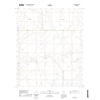
2023 Map of Basin Well
USGS Topo · Published 2023About this map
Nakee Ishee Lake sits at the western edge of this arid landscape, a region defined by the livestock water infrastructure essential to ranching in the Pecos Valley vicinity. The geography is marked by numerous named water features such as Sink Hole Tank and Double Wells Tank, which suggest a long-standing reliance on these catchment points for local industry. The boundary between Chaves and Eddy Counties bisects the northern half of the area, punctuated by the appropriately named County Line Tank. Primary transportation through this section of New Mexico is facilitated by rural routes including Barnaval Draw Rd and Kewanee Rd, which weave through the townships of t15s r29e and t16s r29e.
Find a feature on this map
16 named features on this map. Tap any name to fly to it.
Don’t see what you’re looking for? This feature index may not catch every label — zoom into the map to look around manually.
Map Details
Editions of this 2023 Basin Well Map
This is the sole edition of this map. No revisions or reprints were ever made.
Other maps of this area

1951 · Ninemile Well
USGS Topo · 1:24,000

1951 · King Camp
USGS Topo · 1:24,000

1951 · Diamond Mound
USGS Topo · 1:24,000

1953 · Basin Well
USGS Topo · 1:24,000

1954 · Carlsbad
USGS Topo · 1:250,000

1954 · Hobbs
USGS Topo · 1:250,000

1954 · Brownfield
USGS Topo · 1:250,000

1955 · Red Lake SE
USGS Topo · 1:24,000

1955 · Roswell
USGS Topo · 1:250,000

1955 · Red Lake
USGS Topo · 1:24,000