
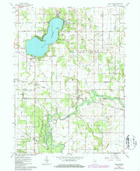
1962 Map of Bass Lake
USGS Topo · Published 1964About this map
Bass Lake serves as the central hub of this early 1960s landscape, flanked by the residential communities of Winona and the Bass Lake State Beach. The map reveals a transition from the lakeside recreation areas to the fertile lowlands of the Tippecanoe River valley to the south. Transportation corridors are well-defined by the Erie-Lackawanna and Chesapeake and Ohio railroads, which intersect the region near Bass Station and Beardstown.
Find a feature on this map
32 named features on this map. Tap any name to fly to it.
Don’t see what you’re looking for? This feature index may not catch every label — zoom into the map to look around manually.
Map Details
Editions of this 1962 Bass Lake Map
2 editions found
Other maps of this area

1953 · Chicago
USGS Topo · 1:250,000

1957 · Chicago
USGS Topo · 1:250,000

1957 · Knox East
USGS Topo · 1:24,000

1957 · Knox West
USGS Topo · 1:24,000

1958 · Donaldson
USGS Topo · 1:24,000

1962 · Winamac
USGS Topo · 1:24,000

1962 · Kewanna
USGS Topo · 1:24,000

1962 · Denham
USGS Topo · 1:24,000
1962 · Ripley
USGS Topo · 1:24,000

1962 · Culver
USGS Topo · 1:24,000